Day eleven. All is well. Still headed north.
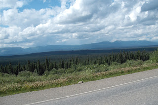
The weather today was again good, with highs in the low 70's and no rain. I began the day in Dawson Creek, British Columbia and traveled north on the Alaska Highway for 281 miles to Fort Nelson, British Columbia. The road along the route was mostly good with some construction-stop delays. Traffic for the first 45 miles, up to Fort St. John, from Dawson Creek, was fairly heavy, with much traffic related to the energy business, either exploration, or some phase of the development of that business. After getting north of Fort St. John the traffic was light to moderate, with mostly campers and others of the tourist variety.
I did not see any wildlife today, or at least I did not see anything that I might also see on a hundred other highways across the USA or Canada.
Although I am still well below the mountain and valley areas over which I will travel, this part of Canada is still desolate back country. If you leave the main road (The Alaskan Highway) there is no pavement, save the small towns along the route, and there are very few of these. Where there are services (gas, food, etc.), and these are rare, outside of the small towns the parking or pull off road surface is all gravel and dirt, and I found no exception to that. There were no side excursions today, and none planned along this highway.
As I travel further up the Alaska Highway the price of fuel gets higher. In Alberta I was paying $1.19 per liter. My last stop today I paid $1.499 per liter. 1 gallon = 3.785412 liter. So, my last stop, when I paid $1.499 per liter, that was equivalent to $5.67 per gallon. Thankfully the bike gets pretty decent mileage. At today's constant speed of 100 Km/h (Appx. 62 mph) I got almost 50 mpg. At higher speeds.....not so good.
My rule of thumb when traveling in areas of limited fuel availability (as here, and in most western states of the USA) is to fill up at the first available opportunity after 100 miles of travel. Today I found one station that my travel guide ("The Milepost") showed as available, was closed. I can conservatively expect 225-250 miles per tank, and there are ample opportunities for gas within that tank-range along the route. But, the distance between opportunities to get fuel could be a problem if not considered and a part of the overall planning.
Tomorrow I will travel over higher elevations, and see even higher elevations to my left toward the west. I expect temperatures to be cooler along my 326 miles of travel to Watson Lake, Yukon. My Weather Channel App on my iPad shows a forecast high of 73 degrees at my departure point, with a 50% chance of rain, and sunny and 80 degrees as a high in Watson Lake, Yukon.
Another good day.


Sounds like you are doing well. I was wondering about your gas milage, glad u mentioned that. I didn't realize so much pre-planning went into a trip like this! Looking forward to Saturday's blog! Safe travels! Lori
ReplyDelete