Day sixteen. All is well. Fairbanks, AK
The sun rose this morning at 5:12 a.m., and it will set at 10:38 p.m. The days are getting shorter in Fairbanks. There are 17 hours and 26 minutes of daylight today. And, surprise, again, the high today was 85 degrees.
In accordance with an appointment and booking nearly six months ago, today I met with a most veteran "bush pilot" and Certified Flight Instructor (CFI) at a local airfield near Fairbanks and began a 2.5 day course of bush pilot instruction in a Cessna 180, F Model. This airplane has a Continental 0-470, 240 HP engine. I was expecting a basic equipped aircraft, but this one is well appointed with a single Garmin 530 as the basic navigational aid, dual VOR heads, and ADF. It is standard 180 gear configuration with the tail wheel, and not what has become the standard tricycle gear. This is standard bush pilot fare.
Yesterday the CFI told me to be there at 6:00 a.m., and I was there ten minutes early. He was already there, and he seemed impatient that I did not arrive earlier. He is a man of very few words, and he is all business. When I first met him yesterday he quipped, "You are not going to learn much in two and a half days." Thirteen words. That was the longest sentence I have heard him speak in two days. After a brief qualification check he passed me to a newbie CFI to get the ground school behind us, then we went to fly. We spent an hour flying where I demonstrated that I knew how to handle a tail wheel aircraft, which included six takeoffs and landings, and then I demonstrated high performance airplane proficiency and leaning. Then we spent the rest of the day doing slow fly and stalls. Over and over and over. When I questioned him about doing something else he did not answer for a full minute. His response, "Did you ever watch the movie Karate Kid?" Eight words. I did not answer.
Actually the stalls are non-events in this airplane, in that it really does not stall. It has a STOL (short takeoff and landing) kit and a cuff, which makes the airplane simply stop flying, and nose over....straight over. No left or right break. You just nose over, lose a little altitude, and then as it again develops lift and starts flying again. I think the key is that in landing configuration I am to get the plane as slow as possible, to the point it is going to quit flying and then give it enough power to create airflow and lift, and thus allow the lowest landing speed and shortest roll possible. At slow flight with very little power I am not seeing a break until about 30 mph. That is slow. It is very mush at this speed.
Back to the CFI. He is not a talkative guy. He tells me in as few words as possible what we are to do for the next exercise. As CFI's go, I have had the animated, the yellers, the talkers, and a few that do not speak much. Maybe he will speak more tomorrow.
At the end of the day I landed the plane, taxied it to where it was tied down when we started flying. We both got out of the plane. In our parting he said, "Tie it down." Three words. Then he goes into the office. After I finished tieing the plane down I go in the office to find out he has left. He left without any guidance for tomorrow. What time? No debriefing. Nothing. I will be there in the morning at 5:30.
Another good day.
Wednesday, August 7, 2013

Tuesday, August 6, 2013
Day 15 - August 06, 2013


Day fifteen. All is well. Arrived Fairbanks.
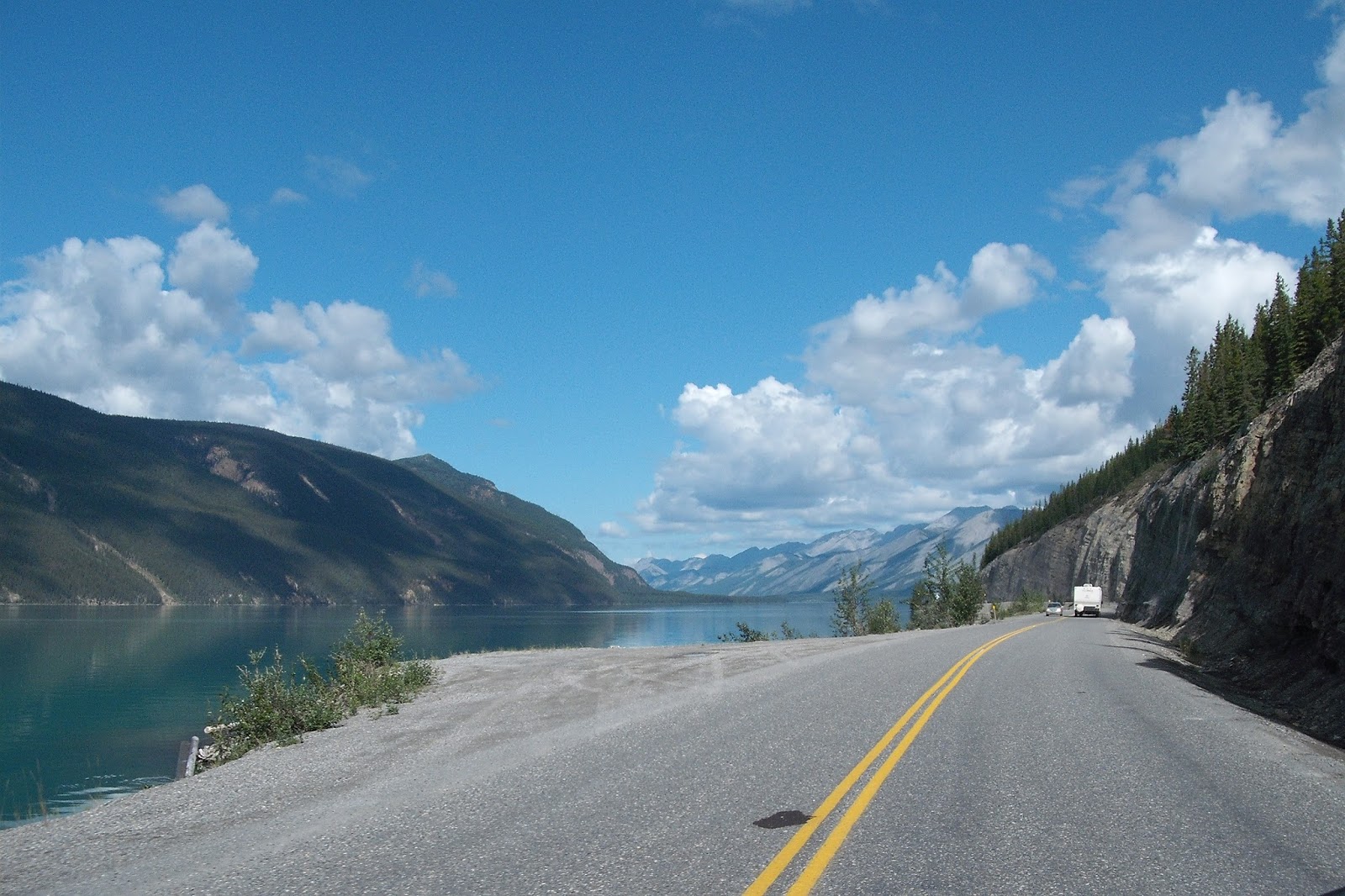
The top photo is one last scenic lake, located fifteen miles south of the Alaska state line, still in Yukon Province, Canada. The second photo is me, contently sitting in front of the "Welcome to Alaska" sign. The photo is compliments of a fellow traveler from Buffalo, NY. 300 miles plus to Fairbanks remaining. Photo three shows the new addition to my helmet. It is there as a commemorative of this journey, and all it represents to me. Photo four is of a distant mountain on the US side . . .still on the Alaska Highway. Lastly is a photo made at the end of this leg of the ride, a closeup of the left lower running light, showing a hole in the lens. This is the only damage to the bike I have located so far.
I will not re-state the listing of negatives about the condition of the highway from previous posts, lest I detract from all of the positives and many joys of the ride. However, I would be remiss if I did not report that today's section of the highway traveled, on the Canada side, was no better, and in some areas worse than the previous two days.
There were very long stretches today and yesterday where there were no services available. Traveler beware.
In yesterday's post I misreported. I said the "guide" that I use for my travels on The Alaska Highway is "The Guideposts". That too is a good "life" guide, but the travelers aid and guide to which I intended to refer is "The Milepost". Here is the link: http://www.milepost.com/.
Today was warmer than yesterday, with no rain. When I arrived in Fairbanks in mid-afternoon it was 81 degrees. I am surprised to see these warm temperatures this far north. I expected temperatures in the low to mid-70's which was incorporated in my planning, But, I guess 81 for a high is not that much out of the range.
Another time zone. Alaska, like Hawaii, has its very own time zone, which is a full four hours behind those on the right coast of this big continent.....the Eastern Time Zone.
I will be in Fairbanks for 3 days. Tomorrow's event determines what I do the following day and 1/2.
Another good day.
Monday, August 5, 2013
Day 14 - August 05, 2013


Day fourteen. All is well. Still headed north.
A quick note about the photos....The photos included are in default sizing for the blog system I am using. If you want to look at a larger, and better quality photos just click it.
I departed Whitehorse this morning and at first the highway was good, and it was good to fair for the first 50 miles or so, and then it got bad, very bad, with the full range of bad, from loose gravel to potholes, to dips, waves, and broken pavement. Many times it was only one of these, but often it was two, three, or more. I reduced speed considerably to adjust, but it was still very rough, and slower traveling.
As I traveled further north the photographic opportunities increased. The reasons for this are three: One, the heavy forestation that was present further south on the highway lessened, and the trees were smaller, providing a more open view to the skies and the mountains. Second, the mountains appeared closer, and were more breathtaking, and three, the sun was shinning more today than yesterday which made for better shots.
I met a biker from New Jersey at my mid-day gas stop. He said he had traveled from Florida. Not a talkative guy. I assumed he was from NJ. The bike had a NJ license plate. Anyway, he was gone in a flash after getting gas. I stayed for lunch. Don't even ask what I got. I am trying to forget it.
Before I left the mid-day stop in rode two BMW riders (always unique in one form or other) who said they were from London, and were here on holiday (that is vacation for us state siders), and they said they were riding the Alaska Highway, and then going to Barrow and the Arctic Circle. These were the only bikers I met that carried auxiliary fuel tanks. Had to ask. The response, "For those off-the-main-road rides when we get to the Arctic Circle." He said that like I understood. I don't.
The weather was cooler today, and at lunch I added another layer to the top. That made for a cozy ride into Beaver Creek.
I was expecting to find more amenities as I got north of Whitehorse and neared the US border. But, I was wrong, and it is the opposite. There was not a gas stop, or any services from my mid-day stop to my evening stop (115 miles). I previous mentioned the guide service that I am using for the trip. It is called Guideposts. It was previously available only in print, but it is now available on line. Each evening I use the on-line version to identify planned gas stops for the next day, so I do not get caught in between..... The benefit of using the on-line version is that it is updated timely.
I am faring well. After two full weeks of being on the bike I am rested, and remain adventuresome. Tomorrow I arrive in Fairbanks, where I spend three evenings. I have things planned. I hope those work out.
Another good day.
Sunday, August 4, 2013
Day 13 - August 04, 2013


Day thirteen. All is well. Still headed north.
Today began in Watson Lake, Yukon. It was cooler than yesterday, and it was cloudy. The clouds lingered north to where I stopped, in Whitehorse, Yukon, but, there was no rain, and the clouds only served to keep to keep the temperatures lower and made the countryside less photographic because of the heavy dark shadows. I was able to capture a few presentable shots.
The top photo is of a restaurant and service station called Bee Jays. It was the recommended place for dining in Watson Lake. I looked at it late yesterday and skipped the evening meal, but I took a go at it for breakfast, and survived...so far.
Photo number two is the approach down the mountain to Tessin, which is a service area, with camping facilities (lots of those along the way), gas, and in this instance a motel and restaurant (photo number three). This is 163 miles north of where I started, and the next service area is at my destination (Whitehorse, Yukon, pop. 23,276). Lunch was a Buffalo burger. Why not? I have eaten buffalo before, and generally prefer the taste of buffalo to beef. But, the burger today did not taste like what I remembered.
Whitehorse is the capital of Yukon.
I keep forgetting to share information about the use of U.S. money in Canada. I was going to do this the right way (my view), which is go to the bank and exchange $400.00 U.S. Dollars for Canada Dollars. I checked the exchange rate on line ($1 U.S. = $1.04 Canadian). That's good. The process sounded simple. So, while in Minot I stopped at a local Wells Fargo bank where I was told I had to go to the main downtown bank. Okay. I go to the downtown, and I am directed to the only person in the bank who can do this, or so I was told. After waiting patiently for her to complete a lengthy transaction of some sort (It did not appear to be a currency exchange.) I began the process. She requested a copy of my driver's license, a separate form of identification, and then my social security number. Then I was told that since I do not have an account at the bank there is a counter fee and an service fee ($15.00 total). She should have told me this from the beginning and we would have both saved time. And she had already put my information in her computer. I hate that. This was wasted effort. I understand that every business has to make money, but this did not set well with me. I remained calm. I understand that businesses have to make money. I did not get upset. I just said, "No, they will take my U.S. money in Canada." She responded, "Are you sure?" I just smiled....as I was leaving.
My experience with U.S. money in Canada is that merchants accept U.S. dollars without question, and for the most part consider U. S. dollars and Canadian dollars interchangeable, although they always give you change in Canadian money. The exchange rate has fluctuated slightly in the last several years, but not dramatically. But, of course I lose $.04 per each $1.00 spent. So where possible I use a debit card, and that way I get the correct exchange rate. By the way, using the exchange rate above, I would have received $415.60 Canadian for $415 U.S (which includes the "fees"). I understand that businesses have to make money.
The highway north of my departure today was better today than what I traveled yesterday. It was still rough, but better. Today there was no more lose gravel. Watson Lake appears to be the center of remoteness. One hundred miles north or south of that point and there are more (only a few) service areas and camp grounds....There are a lot of camp grounds for the folks driving or pulling campers.
Oh, and I did not see the woman struggling with the loose gravel, from yesterday. I am sure she made it. I still can't get over that she has been riding since May.
Another good day.
Saturday, August 3, 2013
Day 12 - August 03, 2013


Day twelve. All is well. Still headed north.
My day started in Fort Nelson, British Columbia, and after a challenging day because of the "loose gravel" and road construction, I arrived safely and without incident at my destination, Watson Lake, Yukon Territory.
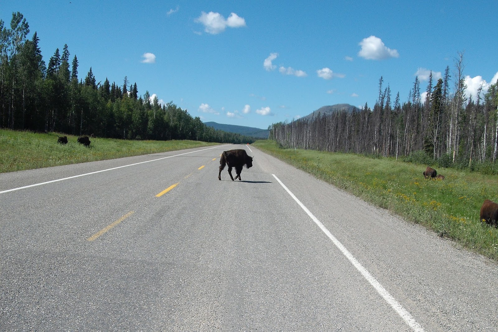
The scenery was spectacular, and there was some wildlife along the way (representative photos included - That is a Black Bear in photo #2.). It was cool, with temperatures in the mid-50's at higher elevations, but by the time I arrived at Watson lake it was 81 degrees.
Tonight I am in Watson Lake, Yukon Territory. The population of Watson Lake, according to Statistic Canada, is 802. The people who live in Watson Lake must work in the tourist service industry, because there are several places to stay and eat, and more than one place for gas. If you are interested in reading more about it you can find it in Wikipedia.
The area is remote.
Until tonight, for my overnight stays, I have not had any trouble connecting to one of Canada's cell systems, but tonight, although there is a cell tower nearby, it will not allow me to call out. Internet has been available at all overnight stops.
I have not seen that many bikers, and today the motor homes on the road were less. I met a few bikes headed south, and I spoke with a few at various rest stops, but there were not as many as I expected.
While traversing a 90 km (56 miles) stretch road with "loose gravel" and on-going construction I passed one biker who appeared to be riding with expectations of becoming one with the gravel at any second. I stopped at the next way station (literally) for the priciest BLT I ever had and as I was readying to leave a mid-30's woman came in and said she was "looking for the rider of the Goldwing parked out front". A chill ran through me and I immediately looked out the window, where I saw my bike where I left it, and not on its side. So quickly my first thoughts that she had run over it went away. After a brief discussion she told me that she was the rider I passed 45 minutes earlier. In our discussion she told me that she had been on the road, riding her motorcycle, since May, riding all over western USA and Canada. She said she was having problems riding on gravel. She wanted advice on how to ride on gravel. The only thing I could tell her was to ride at a speed she felt comfortable riding, and do not let someone else's speed influence how fast you go. Riding since May....wow....
After my not-so-helpful advice she got back on her bike and left ahead of me. Within a short distance I passed her again. I waved, but her hand never left the handlebars. Since May....can't get over that.
Another good day.
Friday, August 2, 2013
Day 11 August 02, 2013


Day eleven. All is well. Still headed north.
The weather today was again good, with highs in the low 70's and no rain. I began the day in Dawson Creek, British Columbia and traveled north on the Alaska Highway for 281 miles to Fort Nelson, British Columbia. The road along the route was mostly good with some construction-stop delays. Traffic for the first 45 miles, up to Fort St. John, from Dawson Creek, was fairly heavy, with much traffic related to the energy business, either exploration, or some phase of the development of that business. After getting north of Fort St. John the traffic was light to moderate, with mostly campers and others of the tourist variety.
I did not see any wildlife today, or at least I did not see anything that I might also see on a hundred other highways across the USA or Canada.
Although I am still well below the mountain and valley areas over which I will travel, this part of Canada is still desolate back country. If you leave the main road (The Alaskan Highway) there is no pavement, save the small towns along the route, and there are very few of these. Where there are services (gas, food, etc.), and these are rare, outside of the small towns the parking or pull off road surface is all gravel and dirt, and I found no exception to that. There were no side excursions today, and none planned along this highway.
As I travel further up the Alaska Highway the price of fuel gets higher. In Alberta I was paying $1.19 per liter. My last stop today I paid $1.499 per liter. 1 gallon = 3.785412 liter. So, my last stop, when I paid $1.499 per liter, that was equivalent to $5.67 per gallon. Thankfully the bike gets pretty decent mileage. At today's constant speed of 100 Km/h (Appx. 62 mph) I got almost 50 mpg. At higher speeds.....not so good.
My rule of thumb when traveling in areas of limited fuel availability (as here, and in most western states of the USA) is to fill up at the first available opportunity after 100 miles of travel. Today I found one station that my travel guide ("The Milepost") showed as available, was closed. I can conservatively expect 225-250 miles per tank, and there are ample opportunities for gas within that tank-range along the route. But, the distance between opportunities to get fuel could be a problem if not considered and a part of the overall planning.
Tomorrow I will travel over higher elevations, and see even higher elevations to my left toward the west. I expect temperatures to be cooler along my 326 miles of travel to Watson Lake, Yukon. My Weather Channel App on my iPad shows a forecast high of 73 degrees at my departure point, with a 50% chance of rain, and sunny and 80 degrees as a high in Watson Lake, Yukon.
Another good day.
Thursday, August 1, 2013
Day 10 - August 01, 2013


Day ten. All is well. Still headed north.
The morning started under bright blue skies in Edmonton, Alberta. The forecast was for unseasonably warm temperatures and no rain for the ride to Dawson Creek. The weather was forecast, with the temperature approaching 80 degrees at the end of the day. 367 miles. This is more miles than I planned for most days this trip, but the roads are good, and the weather was more than cooperating.
It was such a beautiful day so I deviated from the most direct route to follow some of the secondary roads. The roads remained good, and straight (See the top photo.), and almost no traffic. My cell phone was off and tucked away, but my guess there was no cell service either. "Maybe I should have stayed on the main road?" By the time that thought crossed my mind I was well into the belly of the beast (figuratively speaking). So I pressed on. And, I was rewarded with good roads, great scenery, and what I have come to understand is a form of barn art design that has been present all along my route. I should have captured more of these picturesque, unique barns that dot the roadside, but I only got a few, and include two here. I remember Wisconsin as a great source of old and beautiful barns. Out of curiosity I did a quick internet search, and found that what I observed, in both Northern Canada and Wisconsin was observed by others. There are calendars, and books, if you are so inclined.
The long day was rewarded with another time zone change. Pacific now.
And, at last, I am at the start of the Alaskan Highway. It was built from march to September 1942. 1700 miles. When it was constructed, after the attack on Pearl Harbor, Dawson Creek was the southern end. The location was chosen because Dawson Creek was the terminus of the Northern Alberta Railways, and the Canadians of course said it was okay.
Prior to 1931 when the first train arrived in Dawson Creek this was the frontier. The railroad brought a settlement, with a way to ship grain, and timber, so people came. And then 1942 opened the overland route north....to Alaska, connecting the roads for travel for all of North America. If that sounds storybook, it was, because the road conditions were so primitive that highway travel as we know it today did not exist. It was not opened to the public until 1948, and even then it was difficult going. But, again I digress.
Photo four shows the traditional "Welcome . . ." sign and the last photo is the obligatory "Bike under the sign" photo, which was made by a gentleman from Montreal, who was on his BMW motorcycle with his his twelve-year old son. They had been traveling on their bike for the last seven days, and were, like me, headed up the Alaskan Highway in the morning. Like Mecca, this is a destination of choice for those with the time and desire for that one great ride of a life time.
Another good day.
Subscribe to:
Posts (Atom)